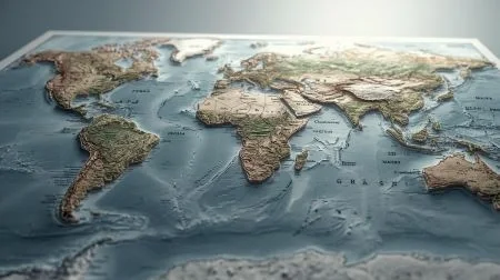
Geography Map is one of the most fundamental and powerful tools in the study of geography, serving as a visual and symbolic representation of the Earth's surface or specific portions of it, depicting physical features, political boundaries, populations, climates, transportation networks, natural resources, and countless other geographical phenomena. Maps are the language of geography — they transform complex spatial data into comprehensible visual formats that allow individuals to understand the layout of the world, navigate from one place to another, and analyze spatial relationships between different geographical elements. The science and art of making maps is known as cartography, a discipline that has evolved dramatically from ancient hand-drawn charts to sophisticated digital mapping technologies used today.
Geography maps are broadly classified into two major types — physical maps and political maps. Physical maps depict the natural features of the Earth's surface, including mountains, rivers, lakes, deserts, plains, and ocean depths, using contour lines, color gradients, and shading to convey elevation and terrain. Political maps show human-defined boundaries such as countries, states, districts, and cities, providing essential information about the administrative and political organization of territories. Thematic maps are specialized maps that focus on specific topics such as climate zones, population density, agricultural patterns, mineral resources, transportation networks, or historical migrations. Topographic maps provide detailed representations of landforms using contour lines, while weather maps depict atmospheric conditions and forecasts.
The elements of a good map include a title, scale, legend or key, compass rose or north arrow, grid lines (latitude and longitude), and a projection system that accurately represents the spherical Earth on a flat surface. Map projections such as Mercator, Robinson, and Mollweide each have unique strengths and distortions, and the choice of projection depends on the purpose of the map. In the modern era, traditional paper maps have been supplemented and largely transformed by Geographic Information Systems (GIS), satellite imagery, GPS technology, and digital mapping platforms such as Google Maps, which allow real-time navigation, spatial analysis, and interactive exploration of geographical data. Geography maps are indispensable tools in education, urban planning, military strategy, disaster management, environmental research, and international relations, making cartography and geographic visualization essential skills in our increasingly spatially aware and data-driven world.